ECO WAVE SOLUTION
THE DRONE SOLUTION
We are
ECO WAVE
SOLUTION HUNGARY
Our goal is to accomplish innovative data collection monitoring, diagnostic processes and block-chain based data storing. We offer high quality aerial and geospatial drone services to our Partners and Customers, which support both the public and private sectors with increased speed and accuracy.
We offer extremely accurate and detailed GIS surveying, drone monitoring, diagnostic testing, mining services, flood estimation, crop health monitoring, topographic surveying, data analysis, 3D mapping, aerial photographing etc.
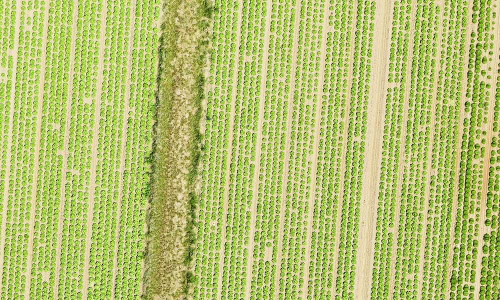
We have carried out successful experiments in field crops, vineyards and orchards in the field of agricultural monitoring and pesticide application.
We offer special drone services in the whole of Europe.
In the second half of 2023, we are going to open our office on the Western part of the USA.
With participation in the international market, experience, teamwork and reliable equipment we have acquired the knowledge and skills to provide the best solutions for our Partners in various industries.
Zsolt Csabanko
Founder and CEO
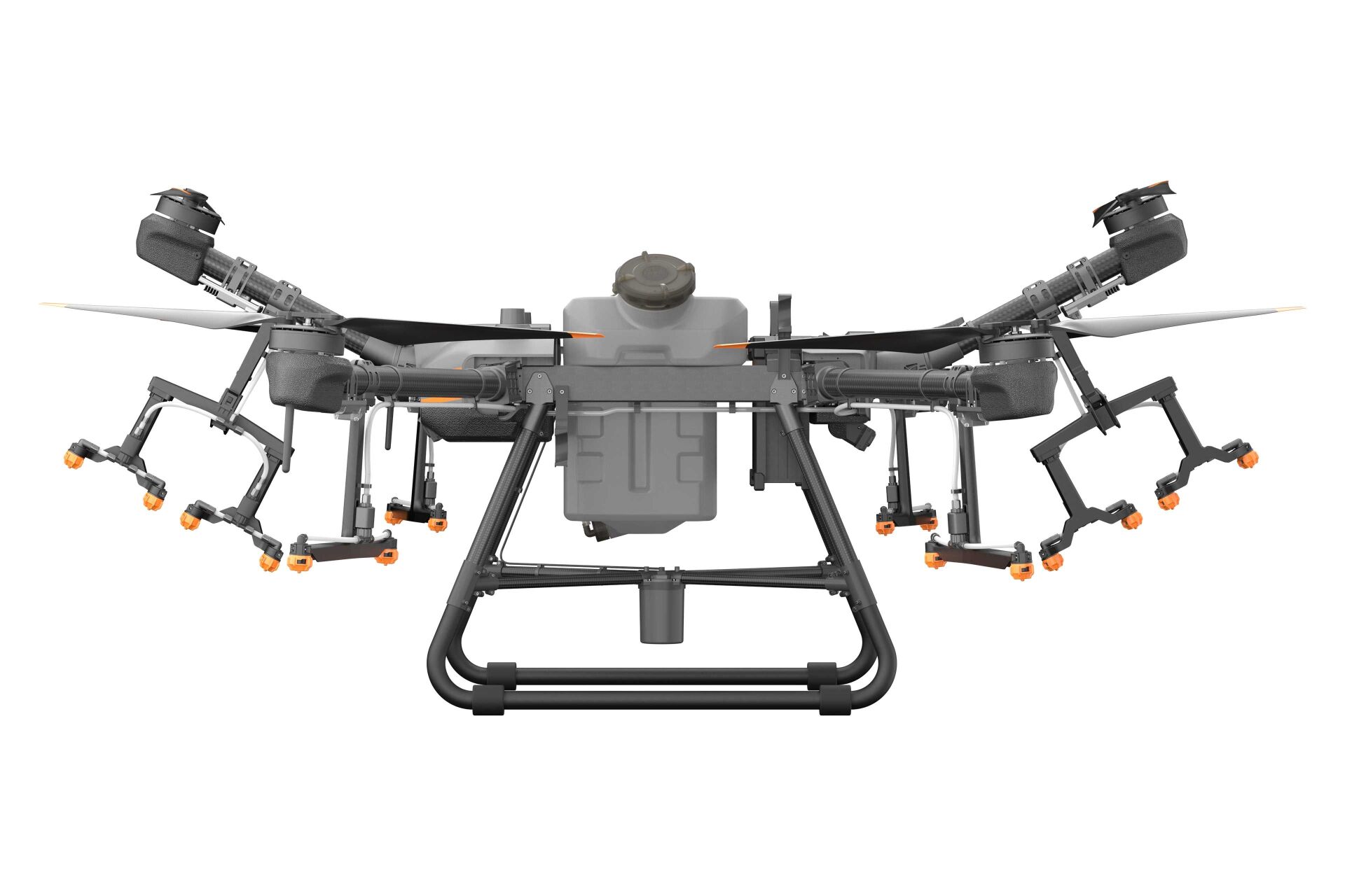
AGRICULTURAL DRONE SERVICE
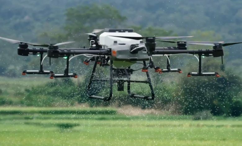
PESTICIDE SPRAYING
Chemicals to kill pests and unwanted plants, such as weeds, as well as pesticides, are essential in keeping the crop healthy. Drones equipped with pesticide spraying equipment operate more efficiently and at a fraction of the cost compared to manual spraying. We not only implement precision agriculture by significantly saving time and labor costs, but also protect farmers from exposure to various toxic chemicals.
SERVICE CANNOT BE PROVIDED UNDER THE CURRENT REGULATIONS! THE CHAMBER'S RESOLUTION ON THE USE OF SPRAYING DRONES IS AVAILABLE AT THE LINK BELOW!
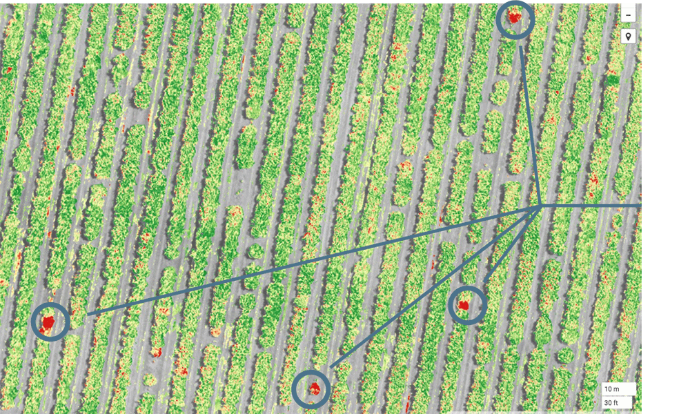
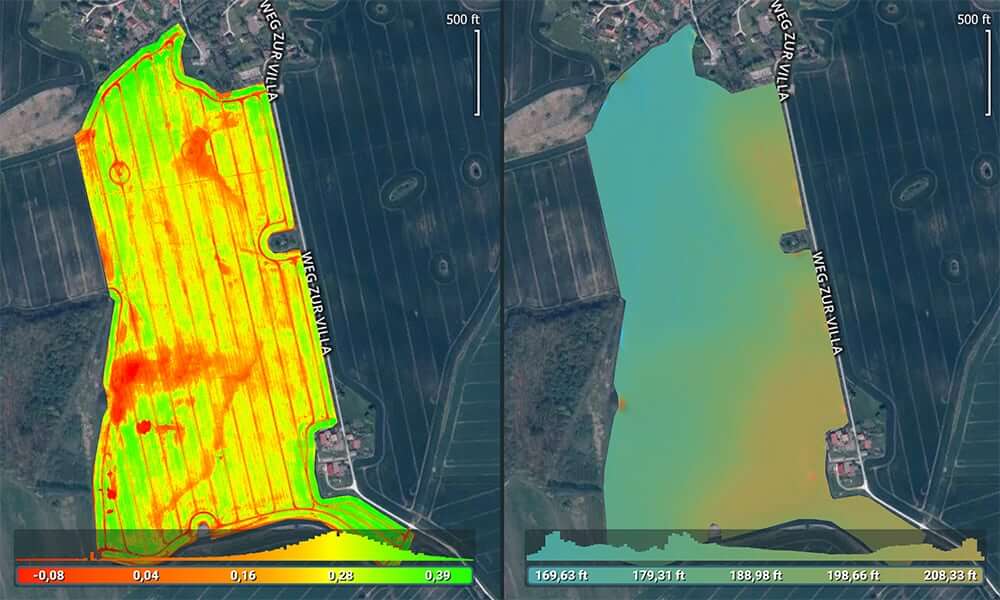
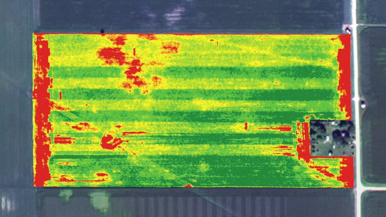
ANALYSIS OF CROP HEALTH AND STRESS
Equipped with multispectral camera sensors, our state-of-the-art drones can detect disease and stress at its earliest stages, sometimes before it is even visible from the ground or with standard color cameras. Our drone surveys also provide real-time images of precision agricultural fields. The resulting data is processed and analyzed in Irrigation Monitoring, Crop Health Monitoring and other essential elements to help farmers focus on management plans.
SUPERVISION AND PLANNING OF IRRIGATION
Our drones equipped with thermal cameras and remote sensing equipment can help eliminate irrigation problems and areas receiving too little or too much moisture. The topography of RGB Imagery's boards helps farmers position and space plants to maximize drainage, follow the natural drainage of the soil and avoid waterlogging. With our services, farmers can comfortably adapt to different environments.
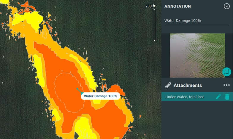
CROP DAMAGE ASSESSMENT
Our experienced drone pilots can access high-resolution data that can provide vital information in response to unpredictable factors such as floods, fires, pests, weather events, and more. to measure and document damage caused by The data collected by drones with remote sensing and photogrammetry are useful information for farmers or government authorities to apply for crop insurance or to obtain a corresponding estimate. Data from advanced sensors, represented as 2D or 3D orthomosaics, help farmers understand the process and find new alternatives to increase crop yield and reduce crop damage.
ANALYSIS OF CROP NUMBER AND PLANT EMERGENCE
With the help of high-resolution data from our drones and machine learning algorithms, we can effectively present production information in order to monitor plant emergence, make replanting decisions and predict yield. From data obtained with premium UAV and photogrammetry, our system results in 97% accuracy. These are represented as their 2D orthomosaics for in-depth understanding.
ARROW LAND SOIL ANALYSIS
Soil quality can make or break a farmer's productivity. Soil analysis is a key step that farmers must take during the growing cycle. Our drones, such as the DJI Matrice 300, provide real-time and accurate analysis of the overall condition of the soil. Through precision agriculture, problems related to soil quality, nutrient management or dead soil zones can be identified. This data helps farmers determine the most efficient management patterns for planting, cropping and soil management, not to mention that field soil analysis also increases worker safety and health.
INDUSTRIAL DRONE SERVICE

Surveying, mapping
We provide services such as GIS, drone surveying, land surveying, warehouse volume analysis, slope monitoring, LIDAR, contours and urban planning. Our services include orthomosaic maps, 3D point cloud, DEM, DTM with centimeter accuracy, and volume analysis and measurement with 99% accuracy.

Aerial inspection, analysis
Our aerial inspection services include infrastructure inspection, power line inspection, wind turbine inspection, solar panel inspection, bridge inspection, railway track inspection, etc. Visual and thermal inspection to detect, monitor and analyze damage caused to devices.

Creative air service
With the help of our professional monitoring drone and editing team, we make breathtaking, cinema-like films for videoing commercial real estate, broadcasting sports events, etc.

UAV data processing
Our team of GIS experts and advanced servers can process and map large-scale data. We offer products such as orthomosaics, 3D point cloud maps, digital terrain models, digital surface models (DSM), contour maps
Special features

Best quality
24/7 Support

Competitive pricing
Follow
CENTRAL OFFICE
CSABA U. 16, 9023 GYŐR.
From Monday to Friday 9:00 a.m. to 3:00 p.m
Telefon: 36 96 488 637 Mobile: 36 30 721 2424 Fax: 36 96 488 637
office@ecowavesolution.com
REPRESENTATIONS