

Surveying
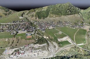
Our customized drone measurement services allow us to create precise topographic maps and 3D models of hard-to-reach areas. Extensive land surveying and topographical surveys help the accurate representation of cadastral maps, immediately and without problems. Our GIS team post-processes the data using photogrammetry software to create outputs such as detailed digital topography model (DEM), digital terrain model (DTM), contours, breaklines, orthomosaics/ortho-images, interactive 3D mode and Land or Building 3D- s reconstruction.
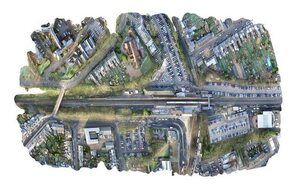
Land management and development
We encourage our clients to use topographic surveys for a more thoughtful land planning and management process. Our spatial planning and spatial development background enables well-defined and faster data provision in safe planning before construction. We focus on site surveying, allotment, planning, and the construction of roads, buildings and utilities. The regular completion of accurate aerial survey and topographic mapping helps to adhere to the construction schedule, while keeping costs down.
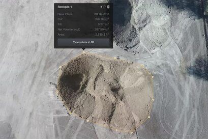
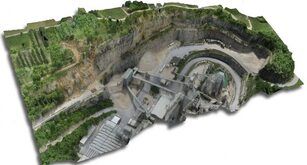
Inventory volume measurements
Drones work with a popular and traditional inventory measurement method in the industry. Our pilots can perform inventory analysis with our highly sophisticated survey drones and capture extensive topographic data that traditional methods may not detect due to their irregular shape. Equipped with the right tools, our drones can record and represent these changes as the actual volume of the shape, not just an estimate. We are able to efficiently deliver photogrammetry information with contouring, digital surface models, and volume measurements with close to 99% accuracy.
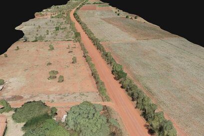
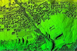
Slope monitoring
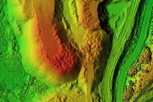
Irregularities in slopes can be a geological hazard, and it is essential to detect them in time to maintain safety. The slope monitoring process carried out by our experts detects the slope of the ground surface with the help of the digital terrain model (DTM) and the digital surface model (DSM). This information, along with LIDAR survey data, is essential for slope monitoring, landslide mitigation, and slope failure prevention. Aerial mapping is a value-added tool that professionals use to track Earth movements to predict and prevent such devastation.
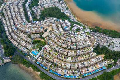
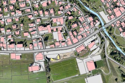
Urban planning
Thanks to the amazing development of drone technology, the use of drones in urban planning has also become extensive. Drone surveying allows us to accumulate enormous amounts of data quickly and at a lower cost due to AI processing and machine learning. We are happy to offer our services to the relevant bodies to plan and examine the existing social and environmental conditions of the sites. A valuable part of our service comes from the recording of high-resolution aerial data, LIDAR surveys and other important information with the most modern drone technology. .
Our services
Orthomosaic cok
Drone images are corrected for image distortions and stitched together in post-processing to create a highly accurate orthomosaic. Each pixel contains 2D geo-information (X, Y) and can directly perform precise measurements such as horizontal distances and surfaces.
3D pontfelhő
A compressed point cloud can also be generated from drone footage. Each point contains GIS (X, Y, Z) and color information. The data obtained in this way provide a very accurate image for distance (slanted and horizontal), area and volume measurements.
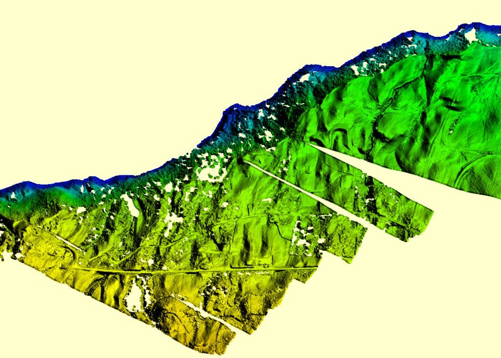
Digital Surface Models (DSM)
With the help of drone footage, we can also create DSM models of the area. Each pixel contains 2D information (X, Y) and the height of the highest point of the site (Z value).
Digital Terrain Model (DTM)
After filtering objects such as buildings, the drone images can be used to create DTMs, each pixel of which contains 2.5D information (the X, Y, and Z values of the highest factor).
Contour maps
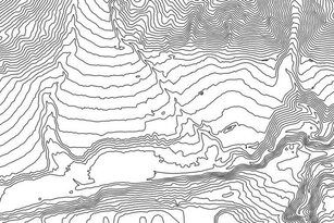
Depending on the requirements of the project, we can create a contour line map with individual contour intervals from either the DTM or DSM model, so we can better examine the surface of the area recorded by the drone.
3D textured mesh
The 3D textured mesh is a reproduction of the edges, faces, vertices and texture of the area captured by the drone. This model is most useful for visual inspections or in cases where external stakeholders or the public are essential to a project.